CCHE2D
CCHE2D is a general surface water flow model. It simulates dynamic processes of water flow and sediment transport, pollutant transport and water quality in rivers, lakes, estuaries and coasts.
|
Key capabilities:
|
|
|
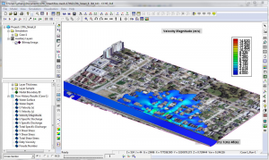
A graphical user interface (GUI) is included with the model. The GUI helps to drive and manage simulation cases, visualize, analyze and animate the simulation results. CCHE2D is a stand-alone model, no third party software is necessary. It can, however, exchange information to and from ArcGIS. |
|
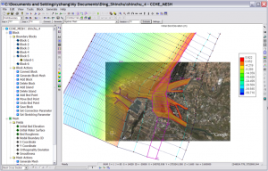
A mesh generator, CCHE-Mesh is also included with CCHE2D. The mesh generator includes several techniques for generating and optimizing structured, unstructured and hybrid meshes. |
CCHE2D is available for purchase in our online store.
Click here for more information on CCHE2D's free surface flow model.
Click here for more information on CCHE2D's coastal model.
Click here for more information on CCHE2D's water quality model.
Click here for more information on CCHE2D's dambreak/flood model.